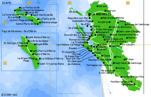
Access to the SAINTONGEmainly located in the department of "CHARENTE-MARITIME"
See the site http://www.evadez-vous17.com/situation/ as an help to prepare tour trip Follows the towns having a touristic office:
|
Detailed
road map (ask it to the touristic
offices).
_____________________________________________ The Charente Maritime in some figures:
SAINTES and JONZAC are in SAINTONGE, the others in AUNIS in term of ancestral provinces.
- to the North, RE just in front of LA ROCHELLE, - At the mouth of the Charente, the island of OLERON, and more modest, the island of AIX and the island MADAM. Clayey limestones of Aunis are convenient has the grain culture, whereas chalky and marly limestones of Saintonge are more adapted has the vineyard, and whereas marshes constitute grasslands favoring the development of the farm and breeding. Charente-Maritime enjoys a moderate and sunny climate, benefiting from a moderate rainfall. The average of the temperatures varies of + 5 ° C in winter and more of + 20 ° C in summer and the level of the precipitation does not exceed 900 mm a year.It is notorious that the rate of period of sunshine of Charente-Maritime is identical that the one of the North of Provence or Languedoc. Swampy on a big part of its coastal zones with the poitou Marsh, the rochefort-marennes Marshes and those of Brouage, the department presents a relief of plains and low plateaus of which the peak point does not surpass meters 167. The river system, directed Southeast / Northwest, is mainly constituted by The Charente and by its tributaries, Boutonne, Seugne, Arnoult, valleys of which form a natural frontier between AUNIS, in the North, and SAINTONGE, in the South. Young countries according to the new administrative
laws of the maritime Charente are: HAUTE SAINTONGE (133communes) SAINTONGE ROMANE (70 communes) VALS DE SAINTONGE (117 communes) RE Island (10 communes) AUNIS (51 communes) MARENNES-OLERON ( 15 communes) PAYS ROCHEFORTAIS PAYS ROYANNAIS (31 communes) and PAYS ROCHELAIS (18 communes) . |
 TGV & TER = railway stations